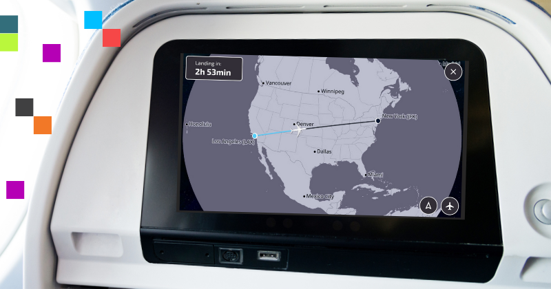
The aviation industry’s number one map, FlightPath3D, has just announced the release of their Accessibility Map.
This innovative model, which expands on the current offerings of FlightPath3D, has been developed to enhance the inflight experience for passengers with a visual, motor or cognitive disability. Through its incorporated accessibility features, users can conveniently access essential flight information and monitor their flight journey according to their individual needs.
To improve readability and reduce unnecessary visuals, the map has been designed with a straightforward and simple interface mainly highlighting major cities and borders. Furthermore, the use of high-contrast display functions that are supported with patterned and textured colours, to better support users with colour-blindness, increases the map’s accessibility towards a wider audience. Notably, airline providers can further customise their map with adjustable text and icon sizes, zoom scale buttons, and interactive finger motion controls for screen display.
This initiative by FlightPath3D demonstrates commitment in complying with the regulatory standards presented by the Web Content Accessibility Guidelines (WCAG) 2.2, and prioritises the delivery of an all-inclusive experience where all users may enjoy the full benefits of digital navigation and flight tracking.
For more information, please read Dahl’s article on FlightPath3D’s announcement of Accessibility Map.
